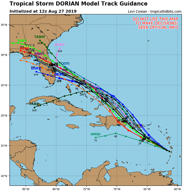
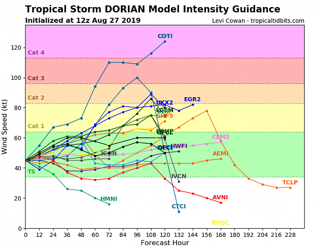
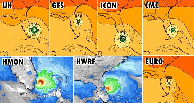
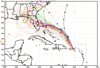
I'm starting this thread to keep track of Dorian. Here's what the models are showing:
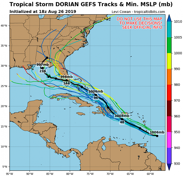
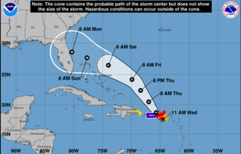
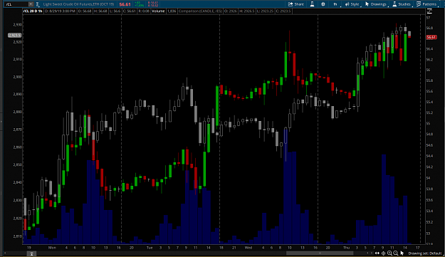
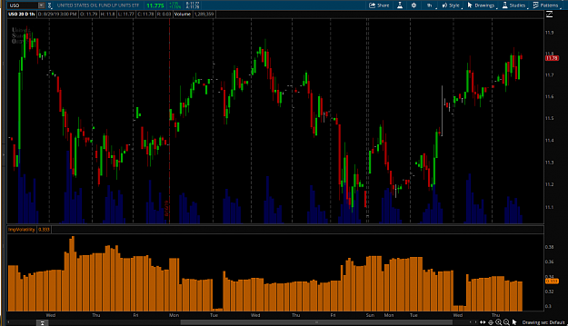
Notice a few models take it across Florida and into the Gulf of Mexico. Should that happen, the potential exists for an energy supply disruption and a big spike in prices. In order for this to happen, first it needs to get past Hispanola and then it needs to take a southern track either under Florida or at least south of Palm Beach County. Its a low probability event at this point, but its worth keeping an eye on.
Update
I'm updating this post to provide some useful resources for tracking the storm.
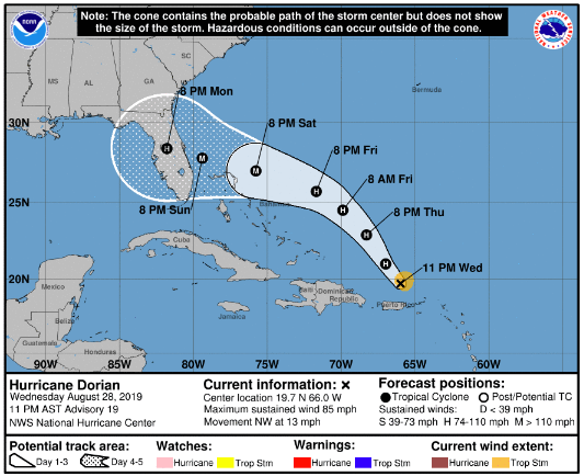
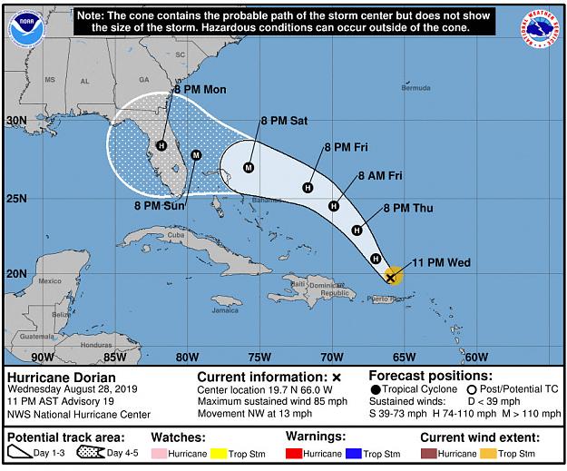
Official NHC track: https://www.nhc.noaa.gov/storm_graph...e_and_wind.png
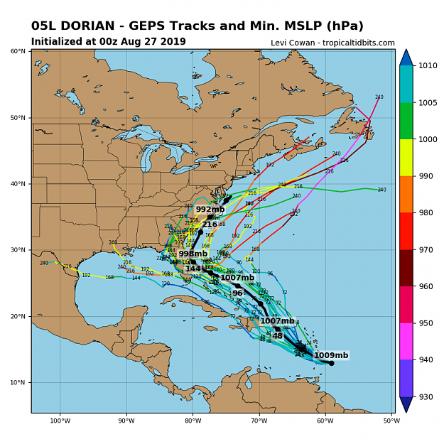
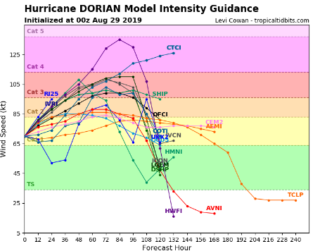
Euro Model: https://www.tropicaltidbits.com/anal...cmwf®ion=us
Best all around site: https://spaghettimodels.com/
Attached Image (click to enlarge)
Notice a few models take it across Florida and into the Gulf of Mexico. Should that happen, the potential exists for an energy supply disruption and a big spike in prices. In order for this to happen, first it needs to get past Hispanola and then it needs to take a southern track either under Florida or at least south of Palm Beach County. Its a low probability event at this point, but its worth keeping an eye on.
Update
I'm updating this post to provide some useful resources for tracking the storm.
Official NHC track: https://www.nhc.noaa.gov/storm_graph...e_and_wind.png
Euro Model: https://www.tropicaltidbits.com/anal...cmwf®ion=us
Best all around site: https://spaghettimodels.com/
Self-sufficiency is the greatest of all wealth. - Epicurus